Sunday, December 18, 2022

2022 Season Summary

The 2022 Atlantic hurricane season was close to average in overall activity, with a total of

16 cyclones attaining tropical depression status,
14 cyclones attaining tropical storm status,
8 cyclones attaining hurricane status, and
2 cyclones attaining major hurricane status.

Before the beginning of the season, I predicted that there would be

20 cyclones attaining tropical depression status,
19 cyclones attaining tropical storm status,
9 cyclones attaining hurricane status, and
5 cyclones attaining major hurricane status.

The average numbers of tropical storms, hurricanes and major hurricanes (over the 30 year period 1991-2020) were 14.4, 7.2, and 3.2, respectively. The eventual numbers for 2022 were quite close to this average, though with realtively few major hurricanes. The (preliminary) Accumulated Cyclone Energy value for the 2022 season was 95, a little below average but well-within "near normal" range. This measure of activity accounts both for strength and duration of tropical cyclones. The exact value sometimes shifts when post-season analysis is complete. This year, my predictions were significantly above the outcome, except in the hurricanes category where it was fairly close. Other official forecasts, such as those by the NOAA and by Colorado State University, were similarly above the mark. So what happened?
As predicted before the season, La Niña conditions prevailed throughout the summer and fall. This meant that equatorial Pacific sea surface temperatures were below normal, as the above diagram indicates for different zones. Such a strong La Niña would usually correlate to increased Atlantic activity, and was a major factor in pre-season forecasts. Atlantic ocean temperatures in hurricane formation zones also ran above normal, so we'll have to look elsewhere for an explanation of the underperformance.

Of particular note is the fact that no tropical cyclones formed during the month of August. This was the first time this had occurred since 1997, and the first time ever that this was observed to happen during a La Niña, dating back to the mid-20th century when detailed observations of the El Niño cycle began. Further, the only storms which formed prior to August were three short-lived tropical storms. The first hurricane was Danielle, which reached hurricane status on September 3, becoming the latest first hurricane in the Atlantic since 2013. In contrast, September through November was an unusually busy period, more consistent with climatological patterns.
The main culprits for the August quiet period were elevated wind shear and dry air. The map above charts the cumulative anomalies in relative humidity in the mid-levels of the atmosphere over the period August 1-22, 2022, vs. 30-year averages. The main development region in the tropical Atlantic east of the Caribbean was the epicenter of a dry air spell which lasted most of the month. Saharan dust was a major contributor to the dry air event. It prevented tropical waves from developing convective activity, which in turn would allow them to build vorticity, gain latitude, and detach from the Intertropical Convergence Zone (ITCZ). When tropical waves reached the Caribbean, another obstacle awaited them.

The first three weeks of August also saw well above average wind shear in the Caribbean sea. Wind shear measures the difference in winds at different heights in the atmosphere; a greater difference in winds prevents atmospheric vortices from the low and mid-levels aligning vertically, or "stacking". This is a necessary ingredient for tropical cyclones to form and strengthen. In comparison to my pre-season prediction, this wind shear event was especially surprising, since I had cited models which indicated wind shear would be below average for the June-July-August period. It's not clear why the model forecast was poor, but the immediate sources of the shear were systems called tropical upper-trospheric troughs (TUTTs). These are large areas of low pressure in the higher levels of the atmosphere, in this case usually located over the central Atlantic northeast of the Caribbean. These features generate counterclockwise flow, which runs opposite to the low-level east-to-west trade winds in the tropics. This combination amounts to high wind shear.

In my region-by-region predictions, I put all sectors of the Atlantic basin at higher-than-normal risk, but had only the Gulf of Mexico at highest risk. Unfortunately, this part of the forecast verified. The strongest winds and largest impacts of 2022 came from Hurricane Ian, which made landfall along the Florida Gulf coast as a top-end category 4 hurricane. Elswhere, Hurricane Fiona was the most impactful; it primarily affected Purto Rico and neighoring islands, as well as Atlantic Canada.

Some other notable facts or records from 2022 include:
  • The 2022 season ended a streak of six consecutive seasons in which a tropical cyclone had formed prior to June 1
  • Tropical Storm Bonnie and Hurricane Julia both crossed from the Atlantic to the Pacific basins and retained their names; this was the first time this had happened twice on record
  • When Fiona made landfall as an extratropical cyclone in Nova Scotia, it broke the record for lowest barometric pressure ever reported in Canada; the new record was 931.6 mb
  • Martin and Nicole were hurricanes simultaneously, which was the third time this had occurred in November, after 1932 and 2001
  • Nicole was the first Florida hurricane landfall in November since Hurricane Kate in 1985
The headline numbers for 2022 tell the story of an average season, but hide several surprising twists. This year is a good reminder that long-term hurricane season forecasts have a long way to go!

Sources: https://www.cpc.ncep.noaa.gov/products/analysis_monitoring/lanina/enso_evolution-status-fcsts-web.pdf, https://yaleclimateconnections.org/2022/08/quiet-in-the-atlantic-will-we-go-0-for-august/

Monday, November 7, 2022

Hurricane Nicole (2022)

Storm Active: November 7-11

Around November 5, a huge area of disturbed weather developed across the eastern Caribbean and neighboring areas of the Atlantic. The system was broad and disorganized, but brought several inches of rain to Puerto Rico and Hispaniola as the strongest storms passed northward through that area over the following day. A low pressure center appeared on November 6 northwest of Puerto Rico, but it was non-tropical in nature at first. This slowly changed as scattered convection developed near the center, and the system was designated Subtropical Storm Nicole early on November 7.

At first, the cyclone moved gradually northwest, but a ridge began to build north of Nicole, turning it toward the west the next day. Meanwhile, despite periodic intrusions of dry air into the center, the storm strengthened steadily. The pressure gradient between the system and the ridge drove some intense winds north of the center; as a result, Nicole had a very large radius of gale force winds, even as the core tightened. The cyclone transitioned to a fully tropical storm on November 8. It actually turned south of west that night and approached hurricane strength as it neared the Bahamas. The storm owed its continued intensification to anomalously warm waters in the western Atlantic; these waters allowed it to reach category 1 hurricane status on November 9. By then, Nicole was close to landfall in eastern Florida. The system didn't look much like a typical hurricane, as it lacked a traditional central dense overcast, but this didn't stop it from bringing strong winds and heavy rain to much of the Florida peninsula.

The center officially moved ashore very early on November 10. In doing so, it became just the third hurricane on record to make landfall in Florida in November, and the first since Hurricane Kate in 1985. Soon after, it weakened to a tropical storm. The ridge to the storm's north moved out toward the east, allowing Nicole to begin a northward turn. It nevertheless emerged briefly over the Gulf of Mexico. It stayed very close to the west coast of Florida though, and soon moved ashore again along the Gulf coast. An approaching front picked up Nicole at that point and began to accelerate it toward the northeast. The storm weakened to a tropical depression that night, and became post-tropical over the southeast U.S. on November 11. It brought a quick hit of flooding rains to regions all along the Appalachians over the next day or so.


Nicole was an unusual hurricane on satellite imagery, with little convection near the center. The above image shows it at landfall on November 10.


Both Nicole's formation point and its westward track were rare for a November cyclone, allowing it to join a small handful of U.S. landfalling hurricanes in the month.

Wednesday, November 2, 2022

Hurricane Martin (2022)

Storm Active: November 1-3

On October 25, a trough of low pressure formed in the western Atlantic, extending from near the central Caribbean islands to near the U.S. East coast. The system was producing a large area of disorganized thunderstorm activity. A low formed along the trough around October 28, but it was non-tropical in nature. The system flirted with tropical status, but didn't quite have enough convective activity to be classified a tropical cyclone. The low passed near Bermuda on October 30, but strong upper-level winds prevented further development. After moving further northeastward, the system found a pocket of favorable conditions and began to strengthen and develop a warm core. On November 1, it became Tropical Storm Martin around 550 miles east-northeast of Bermuda.

The storm had a curved-band appearance on satellite imagery, with most convection extending west and north of the center. Sea surface temperatures weren't particularly warm, but a cold upper atmosphere generated enough temperature gradient for plentiful instability. In addition, a favorable jet interaction helped to drive intensification in Martin. On November 2, the storm accelerated northeastward as it felt the mid-latitude southwesterly flow, and developed a small eye on satellite imagery; as a result, Martin was upgraded to a hurricane that day. Since Martin and Lisa were hurricanes simultaneously, this became the third time in recorded history that two Atlantic hurricanes coexisted in November, after 1932 and 2001.

The cyclone intensified further on November 3, reaching peak winds of 85 mph. However, it was also swiftly becoming extratropical, with the inner core becoming less defined, but the radius of gale force winds ballooning quickly outward as the low deepened. Martin's transition to an extratropical storm on November 3 was extreme in many ways in fact: by the time it became post-tropical, it was absolutely rocketing northeastward at almost 60 mph. Tropical storm force winds extended across a diameter of over 1000 miles, stretching across a majority of the Atlantic around 50 ° N latitude. Finally, though Martin achieved a minimum pressure of 960 mb as a tropical cyclone, it deepened to a low of 932 mb after transition.

After the low's peak in strength on November 4, it began to slowly wind down and move more slowly to the east. Ex-Martin ultimately dissipated northwest of Ireland a few more days after that.


The image above shows Martin after strengthening to a hurricane on November 2.


Martin did not directly affect any land areas, but became a potent extratropical storm with hurricane force winds over the far northern Atlantic.

Monday, October 31, 2022

Hurricane Lisa (2022)

Storm Active: October 31-November 5

During the last week of October, an area of disturbed weather formed in the southeastern Caribbean sea. It moved generally west-northwestward over the next few days, and upper-level winds gradually became more favorable for development. Around October 30, a broad low pressure center formed west of the main convective mass, with several small vortices rotating around a poorly-defined circulation. At that point, it was not yet organized enough to be declared a tropical cyclone. The next day, however, more significant thunderstorm activity popped up closer to the center swirl and the system was classified Tropical Storm Lisa.

At first, Lisa's circulation was not well-stacked, which slowed strengthening in the short term. The steering pattern near Lisa was quite simple: a ridge to its north kept it on a consistent west-northwest track over the next few days. On November 1, the storm passed just north of Honduras, but since it had a small circulation, impacts to that country were minor. By that time, Lisa's circulation had become better defined, but pockets of dry air prevented it from rapidly intensifying. Nevertheless, winds increased steadily, and Lisa ultimately became a hurricane early on November 2.

The hurricane strengthened right up to landfall, reaching a peak intensity of 85 mph winds and a central pressure of 990 mb before moving into Belize that afternoon, bringing strong winds and storm surge to a relatively small area of the coast. The cyclone remained intense, however, as it pushed inland. It was downgraded to a tropical storm that night and to a tropical depression on November 3. Lisa moved west-northwestward and emerged into the Bay of Campeche the next evening. The storm did get a boost in thunderstorm activity once it was back over water, but restrengthening was cut short on November 4 by a sharp increase in upper-level winds. The convection was quickly stripped away from the center of circulation, and Lisa meandered a little longer before dissipating on November 5.


The above image shows Lisa as a category 1 hurricane, right before landfall in Belize.


Lisa was a small cyclone and its effects were mainly felt very close to the forecast track in Belize and southeastern Mexico.

Tuesday, October 11, 2022

Tropical Storm Karl (2022)

Storm Active: October 11-15

On October 10, a disturbance belonging to the same large area of vorticity as the remnants of Hurricane Julia entered the Bay of Campeche. It found a pocket of favorable conditions for development and organized rather quickly over the next day. A large area of convection blossomed near the nascent center of circulation on the 11th and the system was classified Tropical Storm Karl. At the time of naming, the storm was drifting northeastward under weak steering currents, but was far enough from any coastline that it was not impacting land at the moment.

Karl had marginally favorable conditions over the following day and strengthened some, reaching peak winds of 60 mph on October 12. Late that day, a few things changed: first, an area of high pressure moved in over the areas of Mexico west of Karl, setting up an anti-cyclonic steering flow. Since Karl was on the eastern side of that flow, it made a sharp turn and began to move generally southeastward. Second, stronger upper-level winds began to encroach from the northwest, bringing dry air with them. As a result, both the tropical storm and thunderstorm activity were pushed southeastward, and Karl fluctuated in intensity over the next few days as convection was stripped away from the center and then reformed.

By October 14, steady weakening was occurring as the center approached the coast of Mexico along the southern Bay of Campeche. Most of Karl's moisture had been pushed over land, and was causing heavy rain there. The system weakened to a tropical depression as shear overwhelmed it and it became post-tropical early on the 15th just before official landfall in Mexico.


The image above shows Tropical Storm Karl on October 12. Already, the effect of upper-level winds is evident: Karl's center is nearly exposed on the northwest side.


Karl meandered around the Bay of Campeche during its time as a tropical cyclone; impacts were primarily confined to heavy rains along the regions of Mexico south and east of the storm track.

Saturday, October 8, 2022

Hurricane Julia (2022)

Storm Active: October 6-9 (left Atlantic on October 9)

The system that became Hurricane Julia originated as a tropical wave which entered the Atlantic near the end of September. It took a low latitude route across the basin but began to show some spin on satellite imagery by around October 3 as it was approaching the southern Windward islands. On October 4, a surface low formed and was easily visible as a naked swirl of clouds on satellite imagery; all thunderstorm activity was displace southeast of the center. This small vortex was ejected westward and dissipated, while the broad mid-level circulation took a more southerly route. As a result, the disturbance had significant land interaction with the northern coast of Venezuela, which slowed its development. That did not stop the system from being a prodigious rainmaker in that country, however.

Tropical Depression Thirteen formed at last late on October 6, when the center was still located near the coast of Venezuela. A ridge of high pressure was steering the depression quickly westward and also keeping it from gaining latitude. On the 7th, it strengthened into Tropical Storm Julia. Julia had some initial trouble with maintaining a well-defined center of circulation and some shear out of the northeast kept the northern semicircle bare but for some scattered spiral bands. Nevertheless, the warm waters of the Caribbean fueled steady intensification.

The storm veered a little south of west on October 8 and found a pocket of more favorable atmospheric conditions, allowing it to intensify into a hurricane. Extremely intense convection blossomed around the center that night as Julia approached landfall in Nicaragua. The cyclone reached a peak intensity of 85 mph winds and a pressure of 982 mb before making landfall very early in the morning on October 9. The storm brought very high rainfall rates to Nicaragua, but was also still moving quickly, so the rainfall was not prolonged. By the afternoon, the center of Julia emerged into the eastern Pacific, still maintaining tropical storm strength. It was the second storm after Bonnie to maintain tropical storm strength crossing from the Atlantic to the east Pacific; this was the first year that two such events were recorded. Julia maintained the same name as an eastern Pacific tropical storm.

It turned west-northwest and generally moved parallel to the coast of central America, bringing additional precipitation to El Salvador and Guatemala over the next day. Though it was over water, atmospheric conditions and proximity to land prevented the system from recovering, and Julia weakened into a tropical depression; it dissipated near the coast of Guatemala on October 10.


The above image shows Hurricane Julia at landfall very early on October 9.


Julia was the second storm of the year to cross from the Atlantic to the Pacific.

Tropical Depression Twelve (2022)

Storm Active: October 4-6

Near the end of September, a vigorous tropical wave left Africa and moved over the Atlantic. It passed near Cabo Verde a day or so later. The wave was producing significant thunderstorm activity, but took a few more days to organize. Tropical Depression Twelve eventually formed on October 4, not too far west of Cabo Verde. Much like its predecessor, Tropical Depression Eleven, Twelve was moving northwestward toward unfavorable atmospheric conditions by the time it was classified.

The next day, southwesterly shear began to rip convection away from the center, and the environment was only getting harsher. Late on October 6, the depression was downgraded to a remnant low, without having been named. This low dissipated shortly thereafter.


In the above image, the center of circulation of Tropical Depression Twelve is visible as a naked swirl to the west of any thunderstorm activity. This was due to wind shear.


Twelve did not affect any land areas as a tropical cyclone.

Thursday, September 29, 2022

Tropical Depression Eleven (2022)

Storm Active: September 28-29

Around September 21, a small tropical wave a few hundred miles west of the African coast began to produce scattered thunderstorms. Late September is near the end of "Cape Verde season", when cyclones typcially develop from tropical waves in the Atlantic between Africa and the Caribbean islands. At this tail end of the period, steering currents are typically much weaker than in late spring, so tropical waves move more slowly. This disturbance was an extreme case: it meandered around the central tropical Atlantic for a whole week, moving only very slowly the whole time. Toward the end of the week, a persistent area of convection developed, but conditions were only marginally favorable and it took a long time to acquire the organization necessary to be a tropical cyclone. At last, on September 28, it became Tropical Depression Eleven.

Shortly after formation, Eleven managed to start moving a little faster toward the north toward an upper-level trough. Proximity to this trough would be its undoing, however, for wind shear increased the further north it went. After little over a day of being a tropical cyclone, the depression had its thunderstorm activity stripped away toward the northeast by the strong shear and it became a remnant low. This low dissipated very soon after that.


Tropical Depression Eleven was a small and short-lived storm, which did not encounter conditions favorable enough for it to strengthen.


Eleven's slow meandering track as a distrubance and brief tenure as a tropical cyclone did not take it near any land areas.

Saturday, September 24, 2022

Tropical Storm Hermine (2022)

Storm Active: September 23-25

A powerful tropical wave located over Senegal in west Africa entered the Atlantic on September 22 and immediately began to organize. It became Tropical Depression Ten the very next day. Very unusually, it moved north-northwest after hitting the ocean, responding to a weakness in the ridge to its north. That night, it strengthened into Tropical Storm Hermine, stealing the "H" name from Tropical Depression Nine, which only became a tropical storm a little later and therefore was assigned the name Ian.

Hermine managed to produce deep convection to the north-northeast of the center through early on the 24th, but as it moved north conditions turned hostile quickly. Cool ocean waters and strong upper-level winds stripped the center of thunderstorm activity by the afternoon. Since these winds pushed the moisture associated with Hermine northeast, the storm indirectly brought scattered heavy rains to Mauritania, Western Sahara, and the Canary Islands. These regions have a desert climate and it was very rare for them to be affected, even indirectly, by a tropical cyclone. Hermine weakened to a depression that evening. The next day, the shallow system turned back toward the west and became post-tropical. Its remnants dissipated shortly therafter.


The above image shows Hermine just after formation on September 23. The western coast of Africa is visible at right.


Hermine took an unusual northward path in the far eastern Atlantic and brought precipitation to northwest Africa and the Canary Islands, which are visible above and to the right of the storm track.

Hurricane Ian (2022)

Storm Active: September 23-30

A tropical wave moved over the Atlantic around the middle of September. It took a quite southerly track and had little in the way of organized thunderstorm activity before reaching the Caribbean on September 21. Though Caribbean waters were warm, strong upper-level winds from the outflow of the enormous Hurricane Fiona hindered the system from consolidating. Despite this, a well-defined surface low formed on the 22nd. At first, there wasn't enough convection near it to classify as a tropical cyclone, but it became Tropical Depression Nine early on September 23. Only late that day when Fiona was approaching Canada did the associated upper-level winds finally die down enough for the depression to strengthen more easily. It was named Tropical Storm Ian that night. The "I" name was assigned to this storm because in between being named a tropical depression and a tropical storm, a new depression (Ten) formed and took the name Hermine.

Wind shear had diminished, but Ian had internal structural issues to overcome. The low- and mid-level circulations were not vertically stacked, preventing organization for a day or so. Meanwhile, the storm moved westward, passing well south of Jamaica. After the vortices had become better aligned on September 25, the system still had trouble developing deep convection due to dry air inside in the circulation. Ultimately, the favorable conditions of the western Caribbean allowed Ian to overcome this obstacle as well and begin rapid intensification.

This trend brought the storm to hurricane strength by early on September 26 as it gradually curved toward the north. Ian managed to reach category 2 by that night without having a complete eyewall; rather, the core still consisted of spiral bands. Another burst of intensification occurred just before landfall in western Cuba overnight. At landfall, it had maximum winds of 125 mph (category 3 intensity) and a minimum central pressure of 947 mb. The storm's passage northward over land did weaken it, but the inner structure actually improved, if anything. When the center emerged over the Gulf of Mexico during the morning of the 27th, it almost immediately cleared out a large eye. By this time, Ian was feeling the influence of a potent trough of low pressure over the eastern United States and turned very gradually east of north in its southwesterly flow.

The hurricane underwent an eyewall replacement cycle that afternoon. In this process, a secondary eyewall forms outside the first, ultimately contracting and replacing it. Ian's maximum strength did not increase during this process, but its radius of tropical storm and hurricane-force winds increased. A new, larger eye began to emerge that evening. Soon, the hurricane was intensifying again and became a category 4. This trend unforunately continued almost until landfall. Ian ultimately reached a peak strength as a category 5 hurricane with 160 mph winds and a central pressure of 937 mb during the morning of September 28. (Note: Ian was upgraded to a category 5 in post-season analysis; operationally, it was considered a 155 mph category 4 at the time of peak intensity.) A few hours later, the storm made landfall along the western coast of Florida at only the slightly reduced intensity of 150 mph winds and a pressure of 940 mb.

The imapcts to the landfall region were devastating; the slow-moving storm brought significant storm surge just south of the landfall point and extreme rainfall totals generally north of the center. Ian moved northeast across the state for the next day or so and weakened down to a tropical storm before emerging into the Atlantic ocean early on the 29th. By that time, the cyclone was no longer fully tropical; its interaction with a trough had lent it some frontal features. The windfield was large and less concentrated at the center, and similarly for rainfall. Nevertheless, access to the energy of the Gulf stream did help Ian to regain some strength and it became a hurricane again later that day.

Ian made its final landfall in South Carolina during the afternoon of September 30 as a category 1 hurricane with peak winds of 85 mph and a central pressure of 977 mb. Shortly after landfall, the storm lost what remained of its warm core and transitioned to a post-tropical system. The remnants weakened rapidly and merged with another disturbance over the mid-Atlantic the next day. The moisture from Ian contributed to a prolonged rain event for the coastal northeastern United States over the following several days.


The above image shows Ian at peak intensity a few hours before landfall in Florida.


During the latter part of Ian's track, it consistently deviated to the east of most forecasts due to the difficulty of predicting its interaction with a trough over the eastern United States.

Tuesday, September 20, 2022

Tropical Storm Gaston (2022)

Storm Active: September 20-25

On September 15, a tropical wave entered the Atlantic ocean. Some disorganized thunderstorm activity developed near the northern end of the tropical wave over the next couple of days. A weakness in the Azores high pressure allowed the disturbance to lift northward, though this brought it into generally less favorable conditions for cyclone development. Around September 19, a weak low formed in association with the system; rather unexpectedly, it became Tropical Depression Eight the next day. Finding a window of light wind shear and an unstable atmosphere, it began to intensify and became Tropical Storm Gaston by the evening.

Gaston was not completely tropical; it derived some of its energy from baroclinic processes, which allowed it to intensify in a rather unfriendly environment. On the 21st, it became a strong tropical storm. It had moved north-northeast since formation, but turned more toward the east the next day, following a clockwise path around the northern edge of the Azores high. Speaking of the Azores, the system was approaching the westernmost islands by that evening. Gaston was a relatively small storm and was beginning to lose its inner core by that point, but it still brought scattered heavy rains to the Azores beginning late on September 22.

The center in fact veered south and moved very close to the islands the next day. Gaston even underwent an bit of unexpected strengthening and reached its peak intensity of 65 mph winds and a central pressure of 995 mb that afternoon. Soon after, upper level winds and more stable air quelled convective activity and caused the system to weaken. The storm continued its clockwise path, turning back toward the west on September 24. Though a few bursts of thunderstorms halted weakening temporarily, the general degradation of Gaston continued until it became post-tropical on September 25.


The above image shows Gaston approaching the Azores on September 23.


Gaston took a meandering track across the subtropical Atlantic away from any land besides the western islands of the Azores.

Wednesday, September 14, 2022

Hurricane Fiona (2022)

Storm Active: September 14-23

On September 7, a tropical wave emerged off the coast of Africa. It moved steadily west-northwestward over the next several days, but didn't organize too much due to marginal conditions: dry air was still unusally prevalent across the Atlantic basin. Nevertheless, the system ultimately prevailed over its surroundings and became Tropical Depression Seven on September 14. The new depression's center was on the western edge of the main convective mass, but that associated thunderstorm activity was quite vigorous. By later in the day, the system was generating gale force winds and strengthened into Tropical Storm Fiona.

The storm moved due west over the next couple of days and managed to intensify some, even though the center of circulation was consistently outrunning any associated thunderstorm activity. As Fiona's rainbands chased its naked low-cloud swirl westward, the storm began to affect the Lesser Antilles on September 16, bringing a slew of heavy rain to the islands. After entering the northeast Caribbean sea, the system slowed down and the large-scale circulation improved in symmetry. However, Fiona was still ingesting dry air on the 17th. As a result, it was difficult for the tropical storm to develop a central dense overcast, a prerequisite to further strengthening. The system also began to feel a weakness in the subtropical ridge and turned north of west by that evening.

Suddenly, on Sptember 18, Fiona got its act together and started to organize quickly, probably due to higher ocean heat content and moister air in the Caribbean. Late that morning, it strengthened into a hurricane. By that point, the center was approaching the southern coast of Puerto Rico. Rain had already begun on the island, but an exceptional rain event began that afternoon when Fiona's burgeoning eyewall pushed ashore. The center of circulation made landfall in extreme southwest Puerto Rico a few hours after that, but had soon moved northwestward over water again in the Mona Passage.

That night, the storm made a second landfall near the eastern tip of the Dominican Republic as a high-end category 1 hurricane, becoming the first hurricane to make direct landfall in that nation since Hurricane Jeanne in 2004. Fiona passed over only relatively low-lying land areas, so land interaction scarcely hampered the hurricane. Early on the 19th, it emerged off the northern coast and began to strengthen again. An eye became evident on satellite imagery that day and Fiona was upgraded to a category 2. By that time, the rain event had finally concluded in Puerto Rico and most of the Dominican Republic, where over 25 inches of rain were recorded in certain areas.

The far eastern Bahamas also had a close brush with the storm early on September 20 as it turned north-northwestward and passed just to the east of the islands. Though the Bahamas experienced the less intense western semicircle of the storm, hurricane conditions still affected those regions for a few hours. Around the same time, Fiona intensified into the first major hurricane of the 2022 season. The storm moved away from the Bahamas and strengthened further over the next day. Even more pronounced was its increase in size; much of Fiona's decreasing pressure contributed to an expansion of its wind radius through a series of frequent eyewall replacement cycles. Early on September 21, the system reached category 4 status.

The hurricane turned north-norhteast and accelerated that day as it began to feel the influence of a powerful trough over eastern North America. On the 22nd, gale conditions enveloped Bermuda as Fiona approached. That night, the storm reached its peak intensity as a tropical cyclone of 130 mph winds and a minimum central pressure of 932 mb. Fortunately, the hurricane passed well west of Bermuda, preventing it from feeling the worst impacts. The same could not be said for Atlantic Canada: by early on the 23rd, the system was turning back north toward Nova Scotia. The front approaching Fiona began to interact and merge with the hurricane, making the circulation more asymmetric and beginning extratropical transition. Maximum winds dropped but the storm's barometric pressure remained extremely low as it transitioned that day.

When night fell, Fiona was rocketing northward at over 40 mph. It officially became post-tropical late in the evening but this did not mitigate impacts much when it slammed into eastern Nova Scotia in the early morning hours of September 23. Tropical storm force winds affected an extremely large area from eastern Maine to Newfoundland. Hart Island, Nova Scotia recorded a central pressure of 931.6 mb in Fiona; in terms of pressure, the storm's peak intensity likely occurred just after post-tropical transition. Not only that, but this pressure reading was the lowest ever recorded in Canada from any storm in history, crushing the previous mark of 940.2 mb set in a winter storm on January 20, 1977 in Newfoundland. The damage from wind and storm surge was severe in much of Maritime Canada.

After landfall, ex-Fiona slowed down and weakened, eventually moving over Labrador on September 24. The post-tropical storm continued to bring strong winds to Canada as it slowly spun down over the next several days.


The above image shows Fiona undergoing an eyewall replacement cycle on September 21. At the time it was located over the open Atlantic between the Bahamas and Bermuda.


Extremely warm waters and a trough interaction allowed Fiona to remain an extremely intense cyclone upon landfall in Nova Scotia.

Monday, September 5, 2022

A Pacific Hurricane Update: Hurricane Kay (2022)

Though I usually only post on Atlantic tropical cyclones, this post will describe a significant eastern Pacific tropical cyclone, Hurricane Kay.

Storm Active: September 4-9

Around September 1, a disturbance formed in the Gulf of Tehuantepec, off the Pacific coast of southeastern Mexico. The atmosphere in the region was extremely humid and ocean waters were warm, giving the system ample fuel for developement. There was some wind shear present and the disturbance was very large, so it consolidated only slowly over the next few days as it moved generally westward. Satellite imagery indicated that it developed into Tropical Depression Twleve-E around midday on September 4.

It didn't take long for the depression to strengthen into Tropical Storm Kay. Kay had quite a large radius of maximum winds and an impressive satellite signature on the southern side, with curved bands extending hundreds of miles to the south and west. However, the center of circulation was nearly exposed from under cloud cover on the northern side. The storm experienced slow and steady intensification for the next day. By September 5, Kay had managed to wrap convection nearly around its center and a partial eyewall was complete. This lead to a faster increase in winds and the storm was upgraded to a hurricane that afternoon.

Kay gradually turned toward the north over the next day. Even though the center was far from land, southern Baja California experienced intermittent gale conditions from the storm's outer bands. Later on the 6th, the cyclone developed a distinct eye. Kay reached its peak intensity of 105 mph winds and a central pressure of 967 mb early on September 7, just in time for it to encounter cooler waters. This led to a slow diminishing of deep convection near the center, and consummerate drop in winds. Nonetheless, Kay remained a formidable storm as it moved closer to the central Baja California peninsula.

By early on September 8, most thunderstorm activity south and west of the center had died off over cold water. In fact, the heaviest rain associated with Kay was in bands stretching northwestward from the Gulf of California, where the water was much warmer than on the Pacific side and supported stronger storm activity. The system was still a minimal hurricane when it made landfall midway up the peninsula that afternoon. The center of Kay moved north-northwest generally parallel to Baja California's coastline and emerged over water again as a tropical storm. By September 9, the core of the storm was just a swirl of clouds, with flooding rains continuing farther north in far northwestern Mexico and southern California. It turned west under the influence of a ridge sitting over the southwestern United States as it weakened. Later that day, it was classified as post-tropical. The remnants of Kay slowly spun down and the moisture it carried northward brought additional showers to southern California over the next couple of days. Kay was one of only a few cyclones on record to directly affect California.


The image above shows Kay at peak intensity on September 7.


Kay brought beneficial rain to Baja California, southwestern Mexico, and southern California without bringing impacts that are too severe.

Saturday, September 3, 2022

Hurricane Earl (2022)

Storm Active: September 2-10

On August 25, a tropical wave entered the Atlantic ocean. It produced some thunderstorm activity over the next several days as it crossed the tropical Atlantic, but was struggling enough with wind shear and dry air that it didn't manage to organize through the end of the month. The wave turned west-northwestward as it approached the northeastern-most Caribbean islands on September 1. Conditions were still only marginally favorable, but the system managed to develop into Tropical Storm Earl late on September 2.

Around that time, Earl was making its closest approach to the Leeward Islands. Most of the gale force winds were displaced to the north and east of the center, so the islands only recieved scattered downpours from the passing tropical storm. The center of circulation outran the deep convection a little the next day, a sign of continuing wind shear. On the 3rd, the storm passed north of the Virgin Islands and strengthened modestly, but remained fairly disorganized.

The steering currents in the atmosphere around Earl were not very strong. Though the storm was gradually turning north toward a break in the low-level ridge to its north, it did so only very slowly, so occasional heavy rain persisted for a while in the northeast Caribbean, particularly Puerto Rico. The storm was still sheared, but the direction of shear changed by late on September 4 to more closely align with the storm's motion. That pattern is a little more conducive for strengthening, so the resilient Earl continued its slow intensification. The cyclone took on a comma shape, with a long tail of thunderstorms extending south and west of the core. It at last made some progress away from the islands on September 5 and very deep convection began to blossom near the center of circulation.

By the 6th, the storm was moving due north at a sluggish pace. It underwent some more structural change, with hints of an eyewall developing. Earl wasn't the most symmetric storm on satellite, but it managed a remarkable feat of continually strengthening in spite of shear and became a hurricane that day.

The wind shear began a slow decline at last on September 7, allowing the hurricane to gain strength a little more quickly, since it remained over warm water with an ample supply of moisture. That evening, Earl became a category 2. Hurricane hunter aircraft sampling winds in the system over the next day found lower maximum winds than otherwise might have been expected given Earl's appearance on satellite. As a result, the intensity was adjusted down to category 1. However, the storm's central pressure was relatively low, which was consistent with the observed large radius of tropical storm force and hurricane force winds. Earl only expanded further as it gained latitude.

The cyclone made its closest approach to Bermuda from the southeast in the early morning hours of September 9, bringing gale conditions. By that time, the storm was moving north-northeast.

Despite some disruptions to its circulation, Earl made another comeback later that day, regaining category 2 status and reaching its peak intensity of 105 mph winds and a pressure of 954 mb. The storm also briefly had a large eye. It wasn't long though before extratropical transition began, since Earl was encountering colder water off the coast of Atlantic Canada. Before becoming post-tropical, the storm ballooned to a huge size, with an estimated diameter of tropical storm force winds of over 750 miles. At last, the cyclone became post-tropical on September 10. What was left of Earl slowed down and meandered east of Newfoundland for the next several days as it steadily weakened.


The above image shows Earl on September 10 before extatropical transition. Nova Scotia and Newfoundland are visible at top left.


Earl's track was standard fare for a Cape Verde hurricane, but it did reach peak intensity unusually far north.

Friday, September 2, 2022

Hurricane Danielle (2022)

Storm Active: September 1-8

Near the end of August, a low pressure center formed along a decaying frontal boundary over the subtropical Atlantic ocean. Due to very warm ocean waters for that latitude, the disturbance was able to quickly consolidate into Tropical Depression Five on September 1 (the number "Four" had been given to a potential tropical cyclone in the Gulf of Mexico a few weeks prior, though that system never attained tropical cyclone status). Shortly afterward, the depression strengthened into Tropical Storm Danielle. The formation of Danielle ended an incredible drought of cyclone formation in the Atlantic that had reigned since July 3. 2022 was the first year since 1997 that no named storm developed in the Atlantic during the month of August.

Danielle formed around 38 ° N. Storms at that latitude tend to quickly exit northeast and become extratropical, but an unusual blocking high pressure was keeping the system almost in place. As a result, the storm scarcely moved at all over the next few days. In contrast, Danielle was changing quickly in strength. It had a compact circulation with a ring of deep convection about the center, all favorable factors for rapid intensification. By midday on September 2, the storm had already reached category 1 hurricane strength, becoming the first hurricane of the season.

The next day, some dry air from the north invaded Danielle's circulation. This disrupted the eyewall and temporarily weakened the cyclone back to a tropical storm. Eventually, the storm overcame this intrusion and restrengthened to a hurricane late on September 3. Even through the morning of September 4, the storm had hardly moved at all from where it formed. Danielle finally began to budge northward only that evening as it moved toward a weakness in the ridge to its north. Meanwhile, the storm was able to strengthen a little further to its peak intensity of 90 mph winds and a central pressure of 975 mb (a high-end category 1).

The hurricane encountered cooler water as it began to pick up speed and turn toward the northeast. As a result, some of the thunderstorm activity of the inner core collapsed on the 5th, beginning a trend of gradual weakening. Nevertheless, Danielle's satellite presentation remained impressive, with a large eye surrounded for the most part by deep convection. The next day, the storm continued northeast in the mid-latitude westerly flow and an approaching trough increased wind shear in the vicinity. It remained a hurricane through September 7.

By September 8, Danielle had little central convection left. It was downgraded to a tropical storm and became post-tropical right after. The remnants of Danielle executed a counterclockwise loop and then rocketed east. After a few more days, the weakening remnants dissipated near the coast of Portugal.


The above image shows Danielle as a hurricane over the open northern Atlantic on September 5.


Danielle was nearly stationary for its first few days as a tropical cyclone, but climatology ultimately took over and it exited northeast out to sea.

Monday, July 4, 2022

The Weirdest Chess Move, Part 2

This is the second part of a two-part post. For the first, see here.

In the previous post, I discussed some candidates for chess's weirdest move, where "move" here means a move written in algebraic chess notation. Our first two candidates, while rare, have come up in some historical games. Without further ado, here is chess's (notationally) weirdest move:

The weirdest move: Bf3g2#

At first glance, this looks rather innocent. It is a checkmate, but other than that it's just a bishop move, right? However, there's something strange here: both the starting square f3 and destination square g2 are listed for the bishop. Usually, only the destination square is listed in algebraic chess notation. But I'm not changing the notation rules here! There is a technicality that we'll use to our advantage.

The position above comes about in is a very common line in the Queen's Gambit Declined opening: 1. d4 d5 2. c4 e6 3. Nc3 Nf6 4.Bg5 Nbd7. Black has just played the move "Nbd7", moving the queen's knight from its home on b8 to d7, where it reinforces the pinned knight on f6. The notation "Nbd7" is used instead of "Nd7" because there are two black knights that could legally move to d7 on this fourth move! The other knight move would be denoted Nfd7 (a very bad move since white would win the queen). When additional information is required to disambiguate a move, chess notation rules hold that information must be provided about the piece's initial square. The way this information is provided is as follows:

Suppose that a player may move two or more of the same piece to the same square. Then the notation for the move must include one of the following three pieces of information:
  1. The file (column on the chess board, labeled a-h) where the piece originated, such as in the example Nbd7 above
  2. The rank (row on the chess board, labeled 1-8) where the piece originated, if specifying the file does not disambiguate the move
  3. Both the rank and file, only if neither the rank or the file alone can disambiguate the move
We saw an example of (1). As an example where (2) applies, see the following diagram:
Special notation disambiguating moves happens very frequently for rooks, because they are often "connected" on the same rank or file. In the above position, white has just played "R1h5". Both white rooks could move to h5, and they are both on the h file, so the originating rank (the first rank in this case) is provided before the destination square instead.

Though situations (1) and (2) are common enough, applying (3) is almost never necessary. This is because this would require one player to have at least three of the same piece, requiring a promotion of some kind. How rare is it for a player to have three of the same piece? Let's take a look at a few notable examples. There's a line where this can occur straight out of the opening: the famous Lasker Trap.

The game begins 1. d4 d5 2. c4 e5 3. dxe5 d4 4. e3 Bb4+ 5. Bd2 dxe3, arriving at the following position.


So far, only white's fourth move e3 can be considered a mistake, and not a major one. It appears that white can win a free piece by taking the bishop on b4, but this falls right into the Lasker trap! After 6. Bxb4, black responds with exf2+. In this position, white can't take the pawn, and must move the king to e2 (see below).


White has just played 7. Ke2. If white instead took the pawn with Kxf2, the king would no longer be protecting the queen and black wins with Qxd1. The winning move for black is now 7. ...fxg1=N+, underpromoting to a knight! This remarkable underpromotion occurs only seven moves into the game. If black promotes to a queen, the position is equal after white inserts Qxd8+, since after the white queen is captured, white can take the promoted piece on g1, leaving roughly equal material. This means that black must promote with check. After 7. ...fxg1=N+, If white takes the new knight with 8. Rxg1, the skewer 8. ...Bg4+ wins the white queen, so white plays 8. Ke1.


Black can then play 8. ...Qh4+, as shown above. White is lost here: they are down a piece, their king is completely exposed, and black's new knight will be saved. Most importantly for us, the final position features three black knights! They're nowhere near each other, though, so there's no need for disambiguating notation.

A few other quick examples of extra pieces: there have been a few historical games where a player had three queens (requiring two promotions!), and only one game I could find where a player had three rooks, see below. The game was a tournament game between Grigory Serper and Catalin Navrotescu in 1988.


In this position, black can promote and gain a huge material advantage. However, promotion to a queen results in a draw! This is because of a neat stalemate trick: white can perpetually check the black king with their two rooks. If the black king actually captures both, it's stalemate because the new queen on g1 takes away all squares from white's king, and both pawns are locked! Therefore, the winning move is "g1=R", which leaves five rooks on the board! The rook promotion was actually the last move of that game: white resigned. None of the games I found required rule (3) above to disambiguate a move, however.

Moreover, I could not find a single historical game in which one side had three bishops, which is the situation required for our candidate weirdest move. In fact, even more is required than that: one side needs to have three bishops of the same color for rule (3) to apply, which requires at least two bishop underpromotions!

This is the main idea behind my candidate for weirdest move, but I'll quickly run through the other features that led me to the specific choice of "Bf3g2#". First: the choice of squares.


In order for rule (3) to be required to disambiguate, at least three bishops must be able to access the destination square. This means the square in question cannot be a corner or an edge square. The next most unusual choice is a square close to the corner such as g2, since this greatly constrains the positions of the bishops (all three must start among the four squares h1, h3, f1, f3; we'll use the configuration above). Further, the bishop that moves must be on the same file and the same rank as another bishop. We can't have the bishop move from h1, however, because it is impossible to deliver a checkmate with Bh1g2 if it is not a capture. This follows from the fact that the bishop does not attack any square it didn't before, and also could not have gotten out of the way of another piece. Therefore, if we stick to a checkmate without capture, the bishop that moves must start on f3, as shown.

The choice of corner (g2 instead of say, b2) is not particularly important, but with the white pieces is marginally weirder since the promoted bishops would have to retreat back toward white's side of the board and occupy the king's most common position (after kingside castle). Finally, let's consider the checkmate. In a similar vein to the comment above, after moving the bishop from f3 to g2, it doesn't attack any squares (not occupied by white pieces) that it didn't before. Since the move to g2 wasn't a capture, in particular, the bishop already saw the h1 square on the previous move. But then, how can this be a checkmate?

One can see that these conditions force the move to be a discovered checkmate, which is the final bit of weirdness; the bishop on f3 must be blocking a piece that then delivers checkmate to the enemy king. This setup feels even more contrived than having the bishop capture a piece to deliver checkmate, hence my choice of "Bf3g2#". Finally, just to prove that the move could happen, here's a (highly artificial) chess position using the move.

In this image, white has just delivered checkmate with our weirdest move, Bf3g2#.

This example serves to illustrate the huge variety of chess positions that have never been seen in a game before. Maybe this "weirdest move" will appear in a game someday. But I wouldn't bet on it.

Saturday, July 2, 2022

Tropical Storm Colin (2022)

Storm Active: July 2-3

Near the end of June, a tropical disturbance developed over the Bahamas and moved slowly northwestward. It wasn't very organized, but brought rain to the islands and to portions of the U.S. southeast coast by July 1. That day, a low-level circulation center did appear on satellite, located almost exactly on the coastline of Georgia. The atmospheric steering currents weren't particularly strong in the area and the low began to move northeast parallel to the coast as it rounded a high pressure area over the western Atlantic. Unexpectedly, the system maintained enough convection to be classified a tropical cyclone early on July 2. Since satellite data indicated that there were gale force winds off of the South Carolina coast, the system was named Tropical Storm Colin. When named, the center was actually a little bit inland over South Carolina!

Despite forming against the odds, Colin had a little too much to contend with: wind shear out of the west was ripping convection away from the center and the interaction with land further disrupted the cyclone. It steadily lost organization as it moved over North Carolina and ultimately dissipated early on July 3.


The above image shows Colin right after formation as a tropical storm.


Unusually, Colin spent all of its short time as a tropical cyclone (circle points) over land.

Friday, July 1, 2022

Tropical Storm Bonnie (2022)

Storm Active: July 1-2 (left Atlantic on July 2)

The end of June saw unusually favorable conditions in the tropical Atlantic for cyclonogenesis. One tropical wave took advantage of these conditions and began to organize. By June 27, the storm was quickly approaching the Windward Islands and was producing gale force winds, but did not have the closed circulation necessary to be a tropical storm. Its low latitude and fast forward speed toward the west prevented it from taking the final step to development at first. Land interaction compounded these issues the next day when it entered the Caribbean; it was so far south that it was skirting the northern coast of South America.

It was not until a few days later that the system moved into the southwestern Caribbean and again had an opportunity to develop. At last, on July 1, it was designted Tropical Storm Bonnie. By that time, the storm was less than a day from reaching land once again. Bonnie did strengthen somewhat during the day into a moderate tropical storm before making landfall near the border between Nicaragua and Costa Rica. Landfalls this far south in central America are fairly rare, particularly in this part of hurricane season; Bonnie became at the time the southernmost central America landfall for any July system of at least tropical storm strength.

The storm wasn't disturbed much by its passage over Nicaragua since it encountered mostly low-lying land. In fact, the center passed over Lake Nicaragua, which seemed to help preserve the circulation. On July 2, Bonnie emerged as a tropical cyclone into the eastern Pacific. Since the storm remained intact upon crossing from the Atlantic to the Pacific, it retained the name "Bonnie". This was the first time a storm crossed over and kept its name since Hurricane Otto in 2016. Conditions were favorable over water, and the system began to strengthen again. The cyclone developed an unusually large blob of convection to the west of the center that night, but its displacement from the center precluded rapid intensification.

Bonnie was a large cyclone over warm waters, so the wind shear wasn't enough to prevent it from gradually gaining strength. On July 3, it strengthened to a hurricane. The eyewall continued to get better defined and and eye even appeared on July 4, when the system was upgraded to a category 2. It peaked the next day as a category 3 major hurricane. Meanwhile, the storm was on a very steady heading toward the west-northwest. Soon after, however, wind shear and cooler waters began to weaken the system. It slowly decayed for several days before becoming post-tropical on July 9. The remnants dissipatd a few more days after that.


The above image shows Bonnie just before landfall in central America. After traversing the narrow isthmus, it emerged into the Eastern Pacific intact.


Bonnie achieved major hurricane status after moving into the Pacific.

*Note: Bonnie is listed as a tropical storm active from July 1-2 in the post's title because this was the peak intensity it achieved while in the Atlantic basin. It only became a hurricane in the eastern Pacific and is therefore counted as a tropical storm in season totals.

Thursday, June 30, 2022

The Weirdest Chess Move

This post will attempt to answer the question: "What is the weirdest possible chess move?"

More specifically, we'll consider all possible chess move notations, using standard algebraic chess notation. So among possible written moves such as "Ne6", "Qxd7", etc., we want to decide which is the most unusual. I could imagine two different ways of making "weirdest" more precise.

  1. Consider the list of all possible chess games (using standard rules), written down using standard chess notation. Which move notation occurs the fewest number of times in all possible games?
  2. Look at all tournament chess games (with standard rules, etc.) that have occurred in history. Alternatively, let a powerful chess engine such as Stockfish play itself many times and write down all the games. Which move notation occurs with the lowest frequency?
Approach (1) is at least a well-defined question, because the number of chess games is finite, though incredibly large. The reason for this is that by the 50-move rule, any chess game in which there is no capture or pawn advance in 50 moves in automatically a draw; thus pieces cannot shuffle around the board forever and every game must end. One estimate for the number of possible chess games is known as the Shannon number, named after the mathematician Claude Shannon. The estimate is 10120, which vastly exceeds even the number of atoms in the observable Universe! Therefore, it's impossible in practice to enumerate all chess games.

Approach (2) is a little better, but if we use only games that have actually occurred, or a computer sample size small enough to be computationally feasible, it might be too small for any of the "weirdest" moves to appear (we'll see this later). Moreover, we've made some choices about what a sample of representative "good" chess games might look like. I prefer approach (2), though, since the spirit of the challenge is to find what moves come up the least often in a game where both players play sensibly. In any case, my proposed "weirdest move" has not happened in any game that I could find.

The question I'm considering is a little unusual. Instead of looking at possible chess positions, the problem only asks about how a particular move is written down, so the only information we get about the position is from what the notation conveys. This includes the piece moving, the destination square, whether the move is a capture, whether it delivers a check or checkmate, etc.


For example, in the above position, black has just made the move "Nxf3+". The "N" indicates the knight has moved, "f3" is the destination square, "x" means the move was a capture, and the "+" means that the move delivers a check (but not checkmate). However, if we only see the symbols "Nxf3+" in isolation, we don't know what other pieces are on the board, where the knight came from, or where exactly the enemy king is (just that it's in range of the knight's attack).

There are some other notations for special moves in chess, such as castling: kingside castling is denoted "O-O", and queenside castling "O-O-O". The promotion of a pawn is denoted by an "=" sign, for example "e8=Q". In constrast, en passant does not have a special symbol in standard notation.


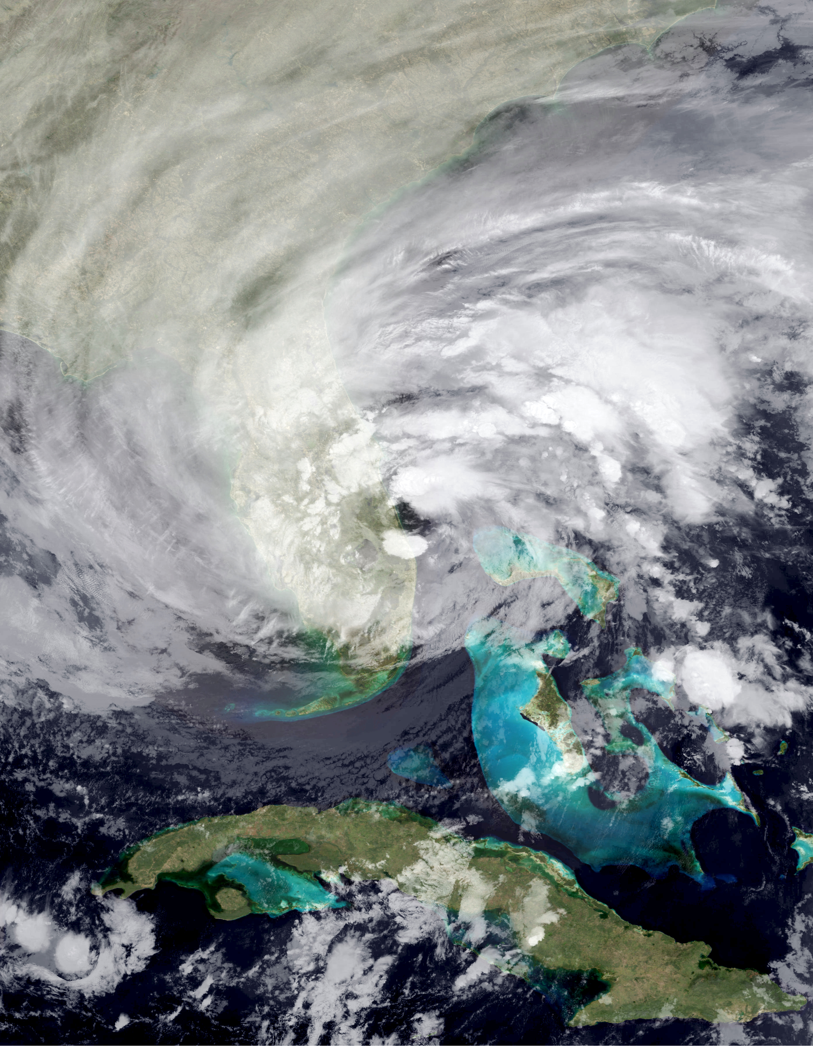
The above image shows a position after black plays "a5". This is an opportunity for white to capture en passant, meaning that white's b-pawn can move to a6 and capture the black pawn on a5 on the next move as if it had moved one square instead of two. However, this is notated simply "bxa6", so if we only know the notation and not the position, we can't distinguish en passant from an ordinary pawn capture.

Let's try a few weird moves. We'll start with castling. Castling on its own happens in almost every game, but it is usually a move to improve king safety in the opening, so it is almost unheard of to check or checkmate with a castling move. Hence, we have our first candidate weirdest move:

Candidate 1: O-O-O#

The notation here means: queenside castle and checkmate. It's an incredibly rare move, but it (nearly) happened in a high-profile historical game! In a 1912 game between international master Edward Lasker (distantly related to world chess champion Emanuel Lasker) and twice British chess champion George Alan Thomas, the following position was reached after black's 17th move, "Kg1".


Lasker had the opportunity to play checkmate in one move with "O-O-O#", our candidate weirdest move! He instead played "Kd2#", which is still checkmate since it allows the white rook on a1 to see the enemy king. Moving the king to deliver checkmate is already a bit uncommon, but the queenside castle would have been stranger still. You might be wondering how on earth the black king arrived on g1 in this game! It was in fact the culmination a remarkable series of forced moves in which the black king went from g8 to g1. The full game is well worth checking out (see here for an explanation of the full game).

Therefore, queenside castle checkmate is rare, but it did almost occur in a game involving two very high caliber players, so maybe we can do better. There's another uncommon move type that's natural to try: underpromotion.

When a pawn reaches the end of the board, it can become a queen, but the player also has the option to trade their pawn for a different piece instead (rook, knight, or bishop). This is called an underpromotion. Since the queen is the most powerful piece in chess, there are very few cases in which a player would "legitimately" underpromote, i.e. where the underpromotion is a superior move to promotion to a queen. Most occurrences of underpromotion in real games are "just for fun", for example when the promoted piece would be captured either way. However, there are some exceptions.


The above position occurred in a game between Vladlen Zurakhov and Alexander Koblents in a 1956 USSR semifinal event. Koblents has just played his knight to f5 and is threatening to win the pawn on g7, which would bring the game to a knight vs. two pawns position that is a theoretical draw. Therefore, white must promote the g pawn. However, if white plays "g8=Q", black will simply win the queen by forking the queen and king with the move "Ne7+". The only move that wins for white is "g8=N", an underpromotion to a knight. This defends against the fork, and the new knight can go on to help one of the two remaining pawns to queen promotion (this is still a difficult win, but Zurakhov did end up winning the game). Since knights can move and attack in ways that queens cannot, it makes sense that knight underpromotions are sometimes practical. Indeed, promoting to a knight is next most common after promoting to a queen. This leads us to our second candidate:

Candidate 2: Bishop underpromotion (e.g., "a8=B")

The rarest underpromotion of all is to a bishop. The bishop's value in chess is roughly equal to the knight's as the lowest of the (non-pawn) pieces, and unlike a knight, the bishop does not move in a way that the queen cannot. In particular, I didn't include a "#" (checkmate symbol) on the example move in Candidate 2, because if a bishop promotion move comes with checkmate, the same move with a queen promotion instead would also be mate. Therefore, no "legitimate" underpromotion occurs that way. I could also have made the move a check or capture, but this makes relatively little difference.

Though some endgame compositions have featured this type of move, there are once again precious few examples in real games. One of the only ones on record is in the following game between Aron Reshko and Oleg Kaminski in the 1972 Leningrad chess championship.


In this position, it's white to move. Though Reshko has a pawn close to promotion, Kaminski has a trick up his sleeve. First, if white does not address the threat on the a7 pawn, the black queen will simply win it in the next move, leading to equal material and a likely draw. If white moves to protect the pawn on its current square by taking the queen to a4 or b8, black can play the queen to f7 for checkmate!

Therefore, white must promote the pawn (or throw in a check with "Qg6+", but the queen must simply return and this gains nothing). However, promotion to a queen or a rook lead to an immediate draw because of black's defensive resource "Qf7+", sacrificing the queen! White's only move is to take the queen, and the resulting position is stalemate, a draw.


The above image shows the hypothetical variation 61. a8=Q Qf7+ 62. Qxf7. Though white is now up two full queens, black has no legal moves and the game is a draw by stalemate. A rook on a8 would also guard the h8 square, so it's again stalemate. Promoting to a knight in the initial position avoids this problem, but it's not too hard to see that the knight can't escape the corner without black's queen capturing it. The only winning strategy, which Reshko found in this position, is to promote to a bishop. Soon after, the players traded queens, and with an extra bishop, white went on to win.

While the bishop underpromotion is the rarest type of move in chess, it is not the weirdest move in terms of notation. I'll reveal my pick for the game's weirdest move in the next post.