On August 10, a vigorous tropical wave emerged off of Africa, and immediately began to produce an area of concentrated thunderstorms southeast of the Cape Verde Islands. On August 11, the system became more organized as a low pressure centered formed. However, the dry air of the eastern Atlantic penetrated the system, and cloud cover rapidly decreased as the low degenerated back into a tropical wave. The wave continued its journey westward, and convection once again erupted over a large area surrounding the system as it entered the moist waters near the Lesser Antilles. A broad upper-level circulation developed on August 16, but the system lacked a surface low, which inhibited further development as it entered the Caribbean Sea. The system moved due west for another few days before developing a surface low late on August 18, and being classified Tropical Depression Eight.
Eight was already producing rain and wind near the Honduras-Nicaragua border at formation, and conditions worsened on the northern coast of Honduras as the cyclone paralleled this coast, just a few miles offshore. Despite its proximity to land, the system developed deep convection and rain bands about the center, and a jog northeast on August 19 made conditions more favorable for strengthening as the day went on. A well-defined eyewall appeared on the south and west sides of the center during the afternoon, and Eight was named Tropical Storm Harvey shortly after.
The cyclone continued on a westward track through the evening of August 19, and strengthened rapidly, reaching an intensity of 65 mph winds and a pressure of 994 mb before temporarily stabilizing in intensity early on August 20. Since the tropical storm force winds extended only about 20 miles south of the center, (they extended 35 miles north at the time) gale force winds missed Honduras for the most part, although heavy rain fell throughout the region. Harvey continued to maintain the above peak intensity through landfall in Belize, which occurred that afternoon.
After landfall, Harvey continued to move west to west-northwest, and maintained a tropical storm intensity for an impressive 12 hours before weakening into a tropical depression over northern Guatemala. Thunderstorm activity continued throughout the region even as Tropical Depression Harvey crossed from inland Guatemala into inland Mexico on August 21. Later that day, the center, which was still well-defined, jogged to the north, and the depression emerged over the Bay of Campeche. With this new found access to water, Harvey strengthened slightly, but did not regain tropical storm intensity before making a turn to the west-southwest and making landfall in the southern Gulf coast of Mexico early on August 22.
Harvey quickly weakened as it moved inland, and dissipated later that morning. Only minimal damage was sustained, but 3 fatalities occurred from flooding, as Harvey dumped many inches of precipitation over Central America. Since Harvey did not reach hurricane strength, the record of consecutive named storms to not became hurricanes to start the season was extended to eight.

Tropical Storm Harvey shortly after formation.
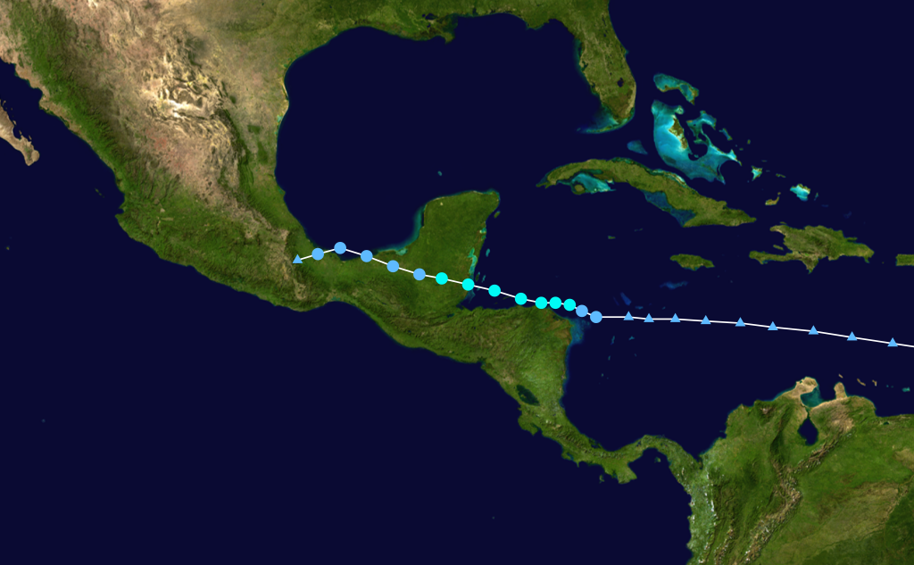
Track of Harvey.
No comments:
Post a Comment