On September 12, a tropical wave near the African coastline began to show signs of development. Beginning the next day, gusty winds and locally heavy rain began to affect the Cape Verde Islands as the disturbance moved west-northwest toward them. The system acquired a surface circulation fairly rapidly and was classified Tropical Depression Twelve on September 14, while still over the islands. Moderate wind shear out of the west kept the center exposed and prevented strengthening over the next day. Late on September 15, however, organization markedly increased and the depression intensified into Tropical Storm Karl.
The next day, thunderstorm activity was pushed a bit farther away from the center by the wind shear, and Karl lost some organization. Additionally, the system took a turn to slightly south of due west by the morning of the 17th. Slight weakening followed, though Karl remained essentially steady state through September 18. The system's direction did change toward the west-northwest, and Karl began to gain latitude. Late on September 19, it appeared that the system was finally starting to organize as shear diminished, but thunderstorm activity collapsed into disorder again the next morning. Upper-level winds had not abated as anticipated, and the Karl in fact weakened to a tropical depression late on September 20th.
The long-awaited relaxation of shear commenced the following day, and the overall structure of Karl became much more symmetric, with banding features and deep convection on all sides of the circulation. This large-scale improvement was unusually not accompanied by any development of the inner core. Rather, it remained broad, rather like a pre-tropical system. As a result, Karl remained a tropical depression through the morning of September 22, still moving northwestward over the open Atlantic. Later that day, the cyclone finally began to strengthen, regaining tropical storm strength that evening and continuing to intensify through the morning of September 23 as outflow drastically improved. The system began to round the edge of the subtropical ridge that day and turned toward the north.
Conditions worsened in Bermuda throughout the day as Karl approached, eventually escalating to tropical storm force winds and heavy rains overnight. The center turned to the northeast just short of Bermuda early on September 24 and the system began to quickly accelerate away from the island. Wind shear was high across the system, but as it was beginning to undergo extratropical transition, there was some increase in intensity that day, bringing Karl to its peak of 70 mph winds and a pressure of 990 mb that night. By the morning of September 25, the cyclone was speeding northeast at almost 50 mph and was declared extratropical.
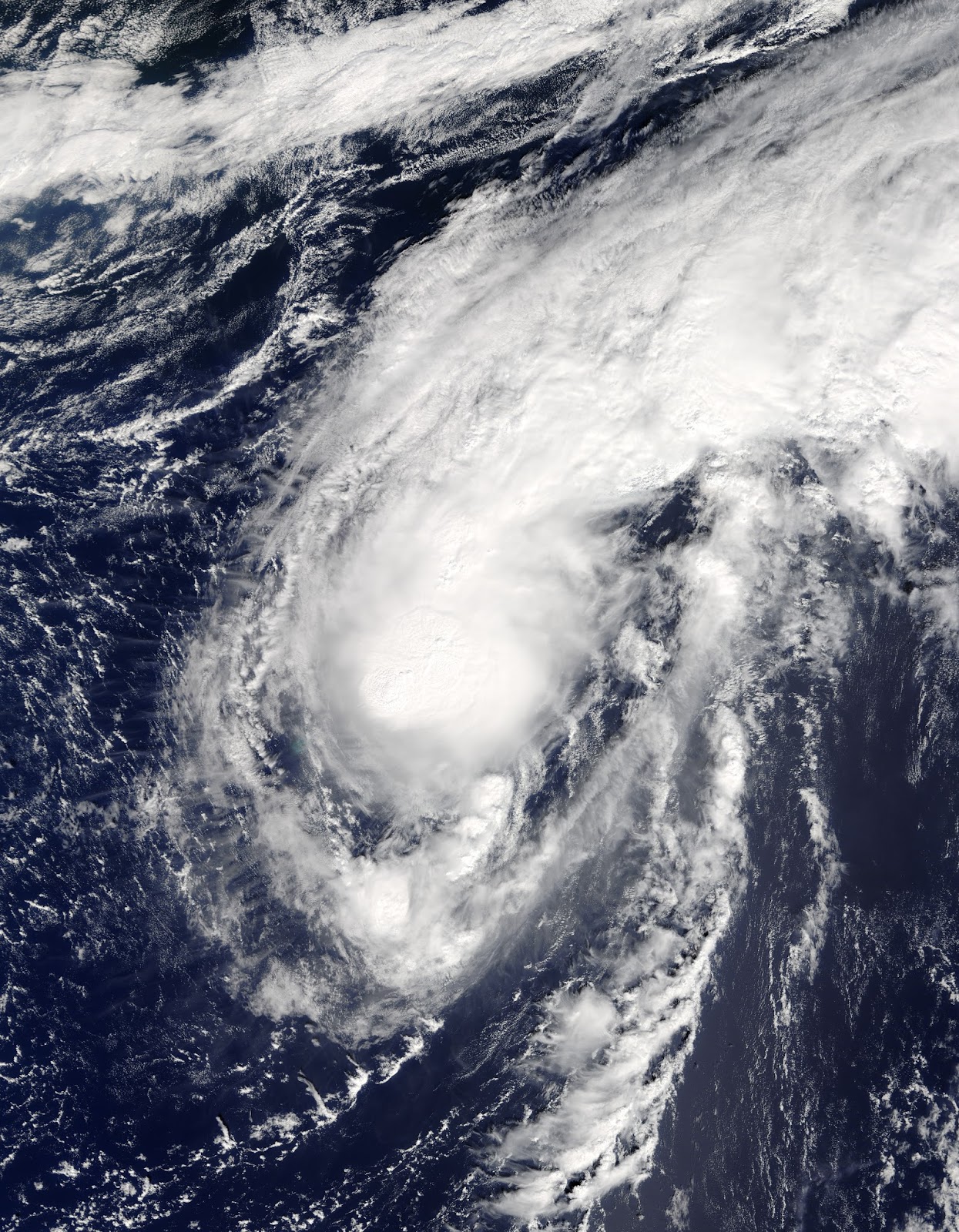
The above image shows Karl just after passing Bermuda.

Despite existing as a tropical cyclone for 11 days, Karl was never able to intensify into a hurricane.
No comments:
Post a Comment