Storm Active: September 8-14, 16-19
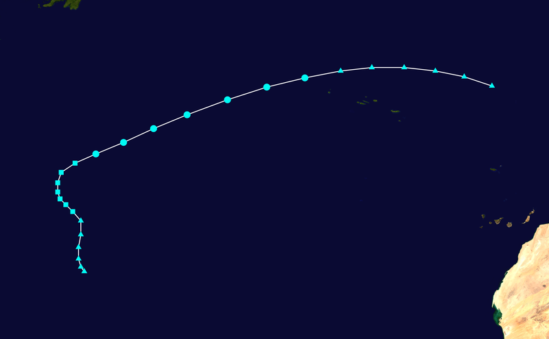
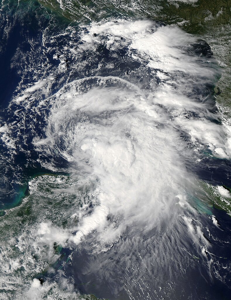
On September 6, a tropical wave over western Africa approached the coastline and began to show signs of development. By the next day, the wave already had a well-defined circulation even as the system still interacted with the African landmass. Thunderstorms rapidly concentrated near the low-pressure center and the system moved westward, and by the afternoon of September 8, very deep convection had appeared just west of the low-level center, and the system was organized enough to be classified Tropical Depression Nine.
In a region of light shear and warm water, Nine began to strengthen immediately, becoming Tropical Storm Humberto early on September 9. During the day, heavy rain and tropical storm force winds began to spread into the southern Cape Verde Islands as the system passed to the south. As Humberto moved away from the islands later that day, shear plummeted further, and banding features improved significantly, suggesting that the storm was undergoing strengthening. The intensification continued steadily into September 10, by which time a weakness in the ridge to Humberto's north was causing it to gradually turn northward.
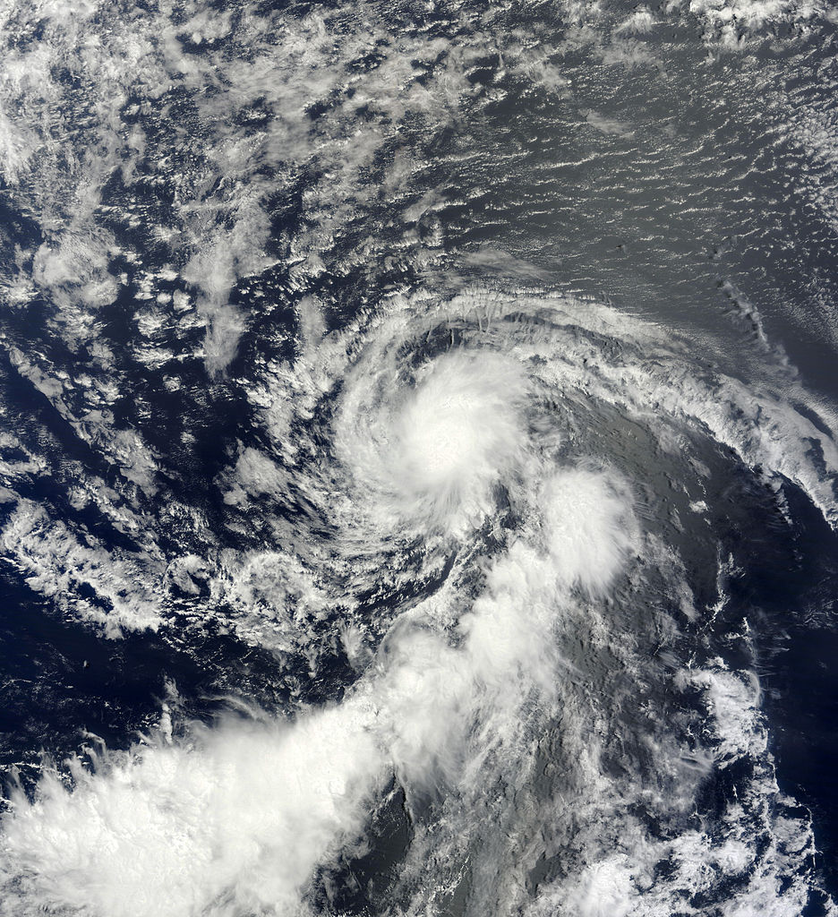
The dry air attempted to invade the system that afternoon, causing the cloud tops to warm near the center, but the structure of the cyclone continued to improve, bringing it to near hurricane strength. Thus, when deep convection recovered and again wrapped around the circulation early on September 11, Humberto had achieved enough organization to be upgraded to a hurricane, and became the first hurricane of the 2013 season.
By that afternoon, the hurricane was moving almost due northward, and was already traveling into cooler waters. However, outflow and banding improved further, and hints of an eye and dense eyewall appeared, suggesting that Humberto had reached its peak intensity of 85 mph winds and a pressure of 982 mb by early on September 12. By this time, Humberto had become a large hurricane and was still expanding, with tropical storm force winds extending up to 170 miles from the center by that afternoon.
But more hostile conditions were beginning to take their toll on Humberto. Driven by stronger shear out of the west-southwest, dry and stable air began to invade the circulation that day, pushing deep convection to the northeastern quadrant of the circulation and weakening the cyclone to a minimal hurricane by early on September 13.
The weakening did not stop there. Later on September 13, Humberto lost all convection whatsoever, and diminished rapidly into a weak tropical storm. Though the circulation itself remained impressive, nearly all cloud cover was lost by September 14. Meanwhile, the rebuilding of the ridge to the north of the system had caused Humberto to turn back to the west. Since by later that day, the system had been without convection near the center for 24 hours, as per standard practice it was downgraded to a remnant low.
Despite the downgrade, the post-tropical cyclone began to gain organization back almost immediately as it moved into warmer waters and more friendly atmospheric conditions. By September 15, a large area of convection had reappeared northeast of the center, but upper-level winds were still too strong for it to wrap around the circulation center. However, on September 16, post-tropical cyclone Humberto gained just enough thunderstorm activity appeared near the center for advisories to be re-initiated. Over the next 18 hours, the newly reformed system had no consistent forward motion, as it was interacting with a mid- to upper-level low. The same low was also still bringing strong shear over the system, causing convection near the center to periodically reform and dissipate, and causing Humberto to fluctuate in intensity, though still remaining a weak tropical storm.
The upper-level low that caused Humberto to meander also altered its structure. During the day on September 17, a large area devoid of convection appeared around the center of circulation, with rain bands enclosing it. Such structures are characteristic of subtropical storms, and this may have resulted from the temporary alignment of the surface low associated with Humberto and the upper-level low with which it interacted. The cyclone began to assume a more definite north-northwestward motion that evening. Convection still struggled to wrap around the center of the system through September 18, so the system was downgraded to a tropical depression that evening. The surface circulation lost definition further on September 19, and Humberto dissipated early that evening.
Humberto became the first hurricane of the 2013 Atlantic hurricane season on September 11, well out to sea. This was the second-latest formation of a hurricane in the satellite era, behind only 2002.
A break in the subtropical ridge in the northeast Atlantic caused Humberto to turn north anomalously far east. This prevented the cyclone from affecting any landmasses, with the exception of the Cape Verde Islands.