Storm Active: September 17-18
Around mid-September, there was an area of disturbed weather just northeast of the Bahamas associated with an upper-level trough. Gradually the vorticity worked down to surface level as the system moved generally north-northwestward over the following days. Shear was fairly high in the area, but the low managed to develop enough convection to be named Tropical Storm Odette off the U.S. mid-Atlantic coast on September 17.
Though it formed pretty close to land, it was already moving out to the northeast. Moreover, it was already beginning extratropical transition! The thunderstorm activity was well east of the center of circulation, and this "center" was in fact multiple low-level swirls orbiting one another. The poorly-organized cyclone degraded further as shear increased, but nevertheless strengthened due to interaction with an approaching front. Just a day after being named, Odette became post-tropical. The low moved out over the open north Atlantic and stalled southeast of Atlantic Canada for a few days. Though it was monitored for redevelopment, ex-Odette did not regenerate into a tropical cyclone. Within a few more days, it was swept away by the next trough entering the Atlantic.
The above image shows Odette shortly after formation. At least three vortices are visible, with the deep convection displaced east of the center.
Odette was only tropical for a day (see circular dots), but the post-tropical low spent several days meandering the north Atlantic after becoming post-tropical (triangular points).
Saturday, September 18, 2021
Sunday, September 12, 2021
Hurricane Nicholas (2021)
Storm Active: September 12-16
During early September, another tropical wave crossed the Atlantic, this one passing through the tropics without incident until it reached the southwestern Caribbean Sea. While the wave moved over central America on September 9, the northern portion pursued a more northwestward course toward the Bay of Campeche. There it merged with a trough, producing a large area of disturbed weather. Southwesterly wind shear made development slow, but the system managed to organize enough to be designated Tropical Storm Nicholas during the morning of September 12.
Nicholas initially moved northward, but turned a little toward the right on the 13th. Though that was the storm's general trajectory, the evolution of the interior was complex. The cyclone reformed to the north and east a few distinct times that day, and at points there were multiple vortices evident on radar, rotating one another cylonically. Despite the lack of a persistent center, Nicholas deepened significantly over the warm waters of the western Gulf of Mexico and reached hurricane strength very close to the coast of Texas that night (attaining a minimum pressure of 988 mb).
Just before landfall, Nicholas turned northeast and slowed down, postponing when it crossed the coastline into the early morning hours of September 14. At the time, it had its greatest peak winds of 75 mph. The storm quickly weakened inland as it moved east-northeast. Nevertheless, it was a prolific rain producer, with storm totals exceeding a foot of rain in parts of Texas and Louisiana. That night, it weakened to a tropical depression. Nicholas lingered near the Louisiana coast for several more days, decaying gradually, but still adding to its rain totals in the south. It became post-tropical on September 16, and finally dissipated on the 17th.
The above infrared satellite imagery shows Hurricane Nicholas just before landfall in Texas very early on September 14.
Nicholas's slow forward motion over the Gulf coast elevated rainfall amounts in Louisiana.
Labels:
2021 Storms
Saturday, September 11, 2021
Tropical Storm Mindy (2021)
Storm Active: September 8-9
A broad low pressure system formed in the extreme southwestern Caribbean near the beginning of September. Due to land interaction and strong upper-level winds, it was disorganized at first as it drifted over Nicaragua and then farther northwest over the following several days. It didn't have the chance to do much more than produce scattered downpours until it cleared the Yucatan Peninsula on September 5. Even then, atmospheric conditions weren't all that favorable as it slowly turned north and then northeast over the Gulf of Mexico. When the disturbance finally did spin up, it was in a hurry. On September 8, a closed circulation suddenly developed off the coast of the Florida panhandle. The system was named Tropical Storm Mindy.
In the few hours it had over water, Mindy developed an impressive core on radar. Winds were estimated to reach 45 mph when the cyclone made landfall that night. The storm weakened to a tropical depression over southern Georgia the next morning and turned east-northeast. Though it emerged back over water by the afternoon of the 9th, conditions were not favorable for restrengthening. This was due to a nearby front and the outflow of Hurricane Larry. Mindy became post-tropical that night and dissipated entirely soon after.
The above image shows Tropical Storm Mindy just after formation and just before landfall in Florida.
Mindy was another short-lived storm which strengthened right before landfall in the U.S.
Labels:
2021 Storms
Wednesday, September 1, 2021
Hurricane Larry (2021)
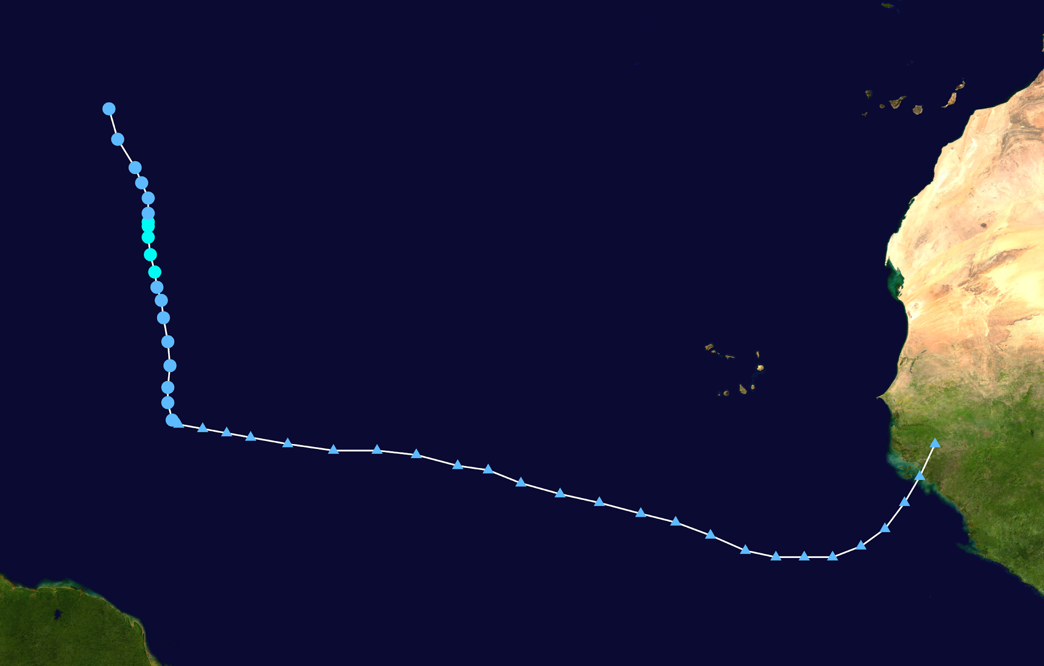
Storm Active: August 31-September 11
An intense tropical wave moved westward across Africa near the end of August, splashing down off the coast of Guinea on the 30th of that month. Unlike some of its predecessors, this system organized almost immediately and was desginated Tropical Depression Twelve southeast of Cabo Verde during the evening of August 31. The storm was large, but strengthened remarkably quickly. Curved convective bands soon surrounded the center and what appeared to be a dry slot in fact was incorporated into the circulation as a proto-eye. The depression became Tropical Storm Larry and didn't stop there. Rapid intensification brought it to the verge of hurricane strength less than a day later. Early on September 2, it was upgraded to a hurricane.
After that point, it took some time for Larry's internal structure to catch up with its impressive outer bands. Over the next day, an eyewall tried to form multiple times, though none of the attempts were quite closed all the way around. Furthermore, the storm had multiple concentric eyewalls at times, complicating the strengthening process. Gradual strengthening continued nevertheless and Larry became a category 2 on September 3. A final burst brought the storm to major hurricane status overnight. From there, it remained a category 3 for several days. uring this stretch, Larry also reached its peak intensity of 125 mph winds and a minimum central pressure of 955 mb. Structural changes continued, however: around September 6, Larry became an annular hurricane. This type of hurricane has a large symmetric eye and little in the way of banding features. They are also more resilient to changes in the surrounding environment.
Indeed, the enviroment around Larry did change some. It slowed down and turned northwest during the same period, and the slower motion over led to more cold water upwelling beneath the storm as it gained latitude. Waters in the area of the subtropical Atlantic it traversed were just as warm or warmer as those it had encountered before, but the high ocean temperatures did not extend as deep, leaving Larry susceptible to churning cold water up under itself. This didn't slow it down too much though, perhaps again due to the annular structure. The storm weakened back to a category 2 only on September 8th as some dry air disrupted the center, but it was larger than ever and was producing rough surf all along the Atlantic coast of north America.
The storm turned the corner and made its closest approach to Bermuda on September 9 as a strong category 1, around 170 miles east-northeast of the island. Despite the center being far away, Bermuda still experienced some gale conditions. From there, the storm turned north-northeast and accelerated as hurricanes usually do in the mid-latitudes. On the 10th, it crossed north of the Gulf stream and encountered much colder ocean temperatures. Despite that, it only weakened a little and maintained an impressive inner core as it slammed into Newfoundland that night. By then, its forward speed was over 45 mph, so hurricane conditions arrived and departed in only a few hours. Remarkably, Larry was still tropical as it entered the Labrador sea, and remained a hurricane north of 50° N. It finally became extratropical on the 11th at a latitude of 54° N.
Soon after, it merged with another extratropical low. Larry's journey northward, along with its interaction with a mid-latitude trough, had the effect of transporting a huge amount of warm air and moisture poleward. As a result, the last impacts of ex-Larry were pretty unusual: on September 12, the combined low moved off the coast of Greenland, causing a huge snowstorm that dumped several feet of snow in areas of southeastern Greenland.
The above image shows major hurricane Larry over the open Atlantic. The lack of outer banding features and large eye are typical features of an annular hurricane.
Larry was the first tropical cyclone to strike Newfoundland as a hurricane since Igor in 2010.
Labels:
2021 Storms
Sunday, August 29, 2021
Tropical Storm Julian (2021)
Storm Active: August 28-29
Another tropical wave was crossing the Atlantic in mid-August when a broad area of low pressure formed along it. Atmospheric conditions didn't support development, however, and the disturbance tracked slowly northwest for several days. The Northern Atlantic Oscillation (NAO) was in negative phase, meaning that the Bermuda-Azores high pressure system was weaker than usual. This gave the system a window to gain latitude before reaching the Caribbean islands. Because it did so, it encountered cooler waters for a while, and organization was again put on hold. Around August 27, the system was at the latitude of Bermuda (though well to the east), and turned eastward. Finally, late on August 28, after tracking across the Atlantic for more than ten days, the disturbance was classified Tropical Depression Eleven.
By that time, the cyclone was already accelerating northeastward in the mid-latitude flow, pushed onward by an approaching cold front. Interaction with this front also drove some intensification and the system became Tropical Storm Julian on August 29. Though it was the eleventh cyclone of the season, it took the "J" name because it reached tropical storm strength while Tropical Depression Ten was still below this threshold. The cyclone reached an intensity of 60 mph winds and a pressure of 995 mb that evening just before transitioning to an extratropical low. It continued across the north Atlantic for a few more days before being absorbed.
Julian had the typical appearance of a cyclone moving northeastward in the subtropics, with an asymmetric, "comma-like" satellite presentation.
A vast majority of the track above shows the system that became Julian before and after its short stint as a tropical cyclone (the four circular dots in the middle).
Labels:
2021 Storms
Tropical Storm Kate (2021)
Storm Active: August 27-September 1
On August 22, an impressive tropical wave entered the Atlantic. It tracked westward at a fairly low latitude and slowly organized. A few days later, it was starting to contend with higher wind shear, making conditions less favorable for tropical cyclone development. Nevertheless, a well-defined low pressure center appeared by early on August 27. Later that day, convection was organized enough to designate the system Tropical Depression Ten several hundred miles east of the Lesser Antilles.
A weakness in the subtropical ridge, expanded by soon-to-be Tropical Storm Julian, drew the new depression generally poleward, and the center was intermittently exposed on the western edge of the convection by northwesterly shear. The shear gradually increased over the next few days as Ten followed its meandering northward path. The storm managed to intensify just enough to be named Tropical Storm Kate on August 30 (though it was the tenth tropical depression of the season, the eleventh snagged the name Julian one day sooner).
Even though wind shear declined from that point, water temperatures were not especially warm and Kate also was encountering a drier air mass. The upper-level winds out of the west were replaced by ones out of the north, bringing even drier air over the center of circulation. It's also the case that a storm moving north is affected more adversely by upper-level winds opposite to the direction of motion (out of the north) than toward the direction of motion (out of the south). This combination led to Kate weakening back to a tropical depression, and then opening up into a trough entirely on September 1.
Kate was a sheared tropical cyclone all its life, as the above photo illustrates. Periodic bursts of convection were immediately displaced southeast of the center.
The beginning of Kate's track shows it as a tropical wave across the Atlantic (triangular points). Once it became a tropical cyclone, the system turned sharply north into a weakness in the subtropical ridge.
Labels:
2021 Storms
Friday, August 27, 2021
Hurricane Ida (2021)
Storm Active: August 26-September 1
Around August 23, a tropical wave that had entered the Atlantic basin back in mid-August began to generate some concentrated thunderstorm activity as it crossed into the Caribbean Sea. Most of the vorticity associated with the system was quite far south, though, and still embedded in the intertropical convergence zone. On the 25th, a broad low formed along the wave axis. In part due to the influence of an upper-level trough over the northwest Caribbean, the system consolidated farther north, culminating in Tropical Depression Nine the next day. At that point, it was located just southwest of Jamiaca and was lifting to the north-northwest.
Initially, most of the rain was displaced north and east of the low-level circulation, causing considerable flooding in Jamaica. The storm was over very warm water and in an environment of high relative humidity, though, so it wasted no time in organizing. By that afternoon, it was upgraded to Tropical Storm Ida. Overnight, vigorous convection began a trend of rapid intensification, which continued through August 27. By the time its center was baring down on western Cuba that afternoon, Ida was already a hurricane. The system first crossed over Isla de la Juventud, before making landfall in mainland Cuba that evening as a category 1. Land interaction barely slowed down the storm, and before long it had continued northwest into the Gulf of Mexico.
Conditions in the Gulf were nearly ideal: wind shear died down even more, the atmosphere was moist, and Ida's path took it directly over a warm eddy that had some of the highest oceanic heat content in the Atlantic basin. Intensification was at first slow and steady as the cyclone cleared out an eye on the 28th and became a category 2 hurricane. During the final day of its approach to the Gulf coast, however, Ida exploded. The minimum central pressure was observed to drop from 985 mb to 929 mb in just 24 hours, bringing the hurricane to category 4 strength with top sustained winds of 150 mph. The storm had also grown significantly and carried an enormous storm surge into southeast Louisiana upon landfall during the early afternoon of August 29. These top winds matched those of Laura a year earlier, tying the record for the highest recorded in a Louisiana landfall.
The storm brought hurricane-force winds well inland as it turned north and weakened. Early on August 30, it was downgraded to a tropical storm and crossed into Mississippi. It became a tropical depression and turned northeastward that evening. Even after bringing 10+ inches of rain to a large swath of Louisiana and Mississippi, Ida caused more tremendous rainfall on its journey toward the Atlantic. An interaction between it and an approaching cold front led to the cyclone's post-tropical transition on September 1, but more importantly led to enhanced precipitation over parts of the mid-Atlantic and widespread flooding. The next day, Ida's remnants moved over Atlantic Canada before dissipating.
The above image shows Ida at peak intensity as a strong category 4 hurricane just before landfall in Louisiana.
Ida's track took it directly across areas of high oceanic heat content in the northern Gulf of Mexico; this contributed to the rapid intensification just before landfall.
Labels:
2021 Storms
Sunday, August 15, 2021
Hurricane Henri (2021)
Storm Active: August 15-23
On August 14, a non-tropical low developed north-northeast of Bermuda in the subtropical Atlantic. It developed surprisingly quickly and had an impressive, if small, satellite signature by the next afternoon. The low was navigating around a high pressure ridge to its west, which was located over the U.S. east coast. This clockwise flow unusually pushed the system south, bringing it just east of Bermuda late on August 15. At that time, it was designated Tropical Depression Eight. Despite its proximity to the island, Eight was so small that Bermuda experience little more than showers.
Anomalously warm waters allowed the system to intensify and become Tropical Storm Henri by the afternoon of August 16. The storm continued its loop around Bermuda and turned west-southwest on the 17th. Curved bands near the center became better defined throughout that day and the storm steadily strengthened. Hints of an eye appeared on satellite imagery on August 18, bringing Henri to the verge of hurricane strength. However, wind shear out of the north increased that evening, squashing the cyclone's cloud shield and halting intensification. The storm proved resilient since it had access to warm ocean temperatures and ample moist air, and only weakened slightly over the next day in the face of 25 knots of shear.
Meanwhile, it continued westward along the 30°N parallel. As the shear abated during the afternoon of August 19, Henri's structure began to improve again. The next morning, it began a long-anticipated turn toward the north as the ridge steering it collapsed and was replaced by a trough along the eastern seaboard. The next morning, Henri strengthened into a hurricane as it accelerated north-northeastward. An eye even opened up briefly on August 21, though it was a bit ragged, and most deep convection was south and east of the center.
Normally, a cyclone in Henri's position would have recurved out to sea, but the setup in this case was quite different. A ridge was building to the system's east, while simultaneously an elongated upper-level low over the mid-Atlantic exerted a pull toward the west. This allowed Henri to defy climatology and continue northward toward land. While located over the Gulf stream, the storm deepened a little more, reaching its peak intensity of 75 mph winds and a minimum pressure of 986 mb early on August 22. The storm began to slow down upon nearing the coast, yet another unusual feature of its track: tropical cyclones that do manage to hit the northeast are typically accelerated to forward speeds of over 30 mph by mid-latitude jet streams. Henri, in contrast, was hemmed in by the ridge and continued to swirl around the upper-level low, turning left around landfall.
Colder waters weakened the storm down to a strong tropical storm before the center made landfall along the coast of Rhode Island that afternoon. Along with some minor storm surge, Henri was primarily a rainmaker. It looped slowly west, weakened to a tropical depression, and stalled over New York state before turning east on August 23. The storm finally became post-tropical that afternoon. What was left of Henri accelerated eastward and moved out to sea the next day.
The above image shows Henri as a minimal hurricane moving north toward New England on August 22.
It's hard to overstate how odd Henri's track was: the cyclone even originated in the subtropics east of Bermuda. For a storm with such an origin to loop back west and hit North America was unprecedented.
Labels:
2021 Storms
Hurricane Grace (2021)
Storm Active: August 13-21
On August 9, a tropical wave entered the Atlantic and moved quickly westward. From the start, the system produced an impressive area of thunderstorms, but its quick motion slowed down development. Four days later, it became organized enough to be designated Tropical Depression Seven well east of the Lesser Antilles. The storm covered ground rapidly, and was approaching the Windward Islands by the next day when it was upgraded to Tropical Storm Grace. Despite the upgrade, aircraft reconaissance indicated that the cyclone had serious structural issues: the low-level center was very ill-defined and difficult to even identify. In fact, sometime around August 14, Grace might have opened up into a trough of low pressure.
Nevertheless, the system was maintained as a tropical cyclone through the 14th, though it did weaken to a depression south of Puerto Rico. Disorganized thunderstorms extended from north of Puerto Rico to well south of the Dominican Republic by the next day along the former tropical wave axis. There were several areas of vorticity, but Grace consolidated some toward the southern end that evening. On August 16, the center was better defined and Grace clipped the souternmost point of the Dominican Republic, still as a tropical depression. Heavy rainfall in Hispaniola led to the risk of mudslides and flooding.
Land interaction lessened from that point and Grace slowly became a bit better organized as the strong subtropical ridge continued to push it just north of west. The center passed just south of Haiti that night, thankfully sparing the country the heaviest rainfall. Early on August 17, the storm regained tropical storm strength just in time for a direct hit on the island of Jamaica. The small country was not enough to significantly disrupt the cyclone, and in fact it strengthened gradually and grew in size that day. By the time it emerged off the west coast of Jamaica, Grace was a strong tropical storm.
Now over open water, the storm could tap into the highest oceanic heat content anywhere in the Atlantic. Relative humidity levels near Grace were only moderate (in the 50-60% range), which slowed the storm's intensification with occasional dry air intrusions. Otherwise, there was little to stop its strengthening and the cyclone was upgraded to a hurricane on August 18. The storm reached its first peak intensity of 80 mph winds and a pressure of 986 mb overnight before making landfall in the northern Yucatan peninsula before sunrise on August 19. The storm weakened over land and became a tropical storm late that morning, but maintained a vigorous circulation and emerged as a still strong tropical storm into the Bay of Campeche that evening.
Atmospheric conditions were better in the southern Gulf of Mexico than they had been over the Caribbean, with ample moisture in the air. It didn't take long for Grace to take advantage. By the morning of August 20, it had regained hurricane strength and extremely deep convection began firing north and east of the center. This managed to wrap all the way around by the afternoon and the cyclone rapidly intensified. Remarkably, it went from a category 1 to a high-end category 3 by late that night, becoming the first major hurricane of the 2021 season. An eye feature began to clear out just before Grace made its final landfall in Mexico very early in the morning on August 21. At landfall, Grace had an estimated peak intensity of 125 mph sustained winds and a minimum central pressure of 962 mb. This was the highest windspeed in a recorded landfall along the Mexican Gulf coast south of Tampico, surpassing Karl of 2010.
After moving inland, the mountainous terrain of Mexico quickly weakened the cyclone, bringing it to a tropical storm by that afternoon. Grace dissipated entirely by that evening after bringing heavy precipitation even as far as Mexico City. The remnants continued into the eastern Pacific ocean and ultimately reformed into a tropical storm early on August 23. Since the circulation had dissipated and reformed, however, the cyclone received a new name: Tropical Storm Marty. Marty persisted for only a few days before becoming post-tropical.
The above image is an infrared satellite view of Grace on the night of its final landfall in Mexico as a major hurricane.
A strong subtropical ridge kept Grace moving on a steady trajectory just north of west for almost its entire existence.
Labels:
2021 Storms
Wednesday, August 11, 2021
Tropical Storm Fred (2021)
Storm Active: August 10-14, 15-18
Around August 1, a tropical wave left Africa and entered the Atlantic. The wave did not develop much over the following 6 days, as conditions were not favorable and there was another wave closeby to the east. A few hundred miles east of the Windward Islands, the disturbance won out over its neighbor and developed a broad low-pressure center. By August 9, the system was located just north of Barbados. It moved west-northwestward into the Caribbean soon after. The circulation was quite impressive on satellite imagery: it had well-defined banding features and a clear spin. Nevertheless, it wasn't until that night that a center of circulation formed and it was upgraded to Tropical Storm Fred south of Puerto Rico.
Fred was dealing with dry air to its west, but its immediate problem was land interaction. After missing Puerto Rico to the south, the storm hit Hispaniola directly on the 11th, passing directly over the center of the island by that evening. The circulation was significantly disrupted and Fred weakened to a tropical depression. Though the cyclone was back over water overnight, there was some wind shear out of the west and it left most of its thunderstorm activity behind. It took most of the day on August 12 for Fred to slowly recover as it paralleled the northern coast of Cuba.
More land soon interrupted this reorganization, as Fred moved over central Cuba the next day. In fact, the low-level circulation became impossible to locate by that evening. Sometime soon after, Fred degenerated into a trough of low pressure and ceased to be a tropical cyclone temprorarily. However, heavy rains were still widespread across the region, so this changed the overall imapcts little. The system's remnants moved west-northwestward into the Gulf of Mexico on August 14 and began to organize again. The wind shear was a bit more favorable and ocean temperatures were warm as ex-Fred rounded the edge of the subtropical ridge and moved north-northwestward well west of Florida. On August 15, the circulation closed off and the system regained tropical storm status.
At first, the center was exposed on the western edge of the convection, but a semicircular core blossomed that evening and Fred began to strengthen. This trend continued through the morning of August 16 and Fred turned just east of north. By that time, the storm had a classic "comma" appearance, with a large curved band on the east side and a dry slot just southeast of the center. Some dry air intrusion via this slot capped Fred's intensity, but it still managed to become a strong tropical storm with top sustained winds of 65 mph before its final landfall in the Florida panhandle that afternoon. After landfall, the cyclone weakened steadily but brought a wide swath of heavy rain to the U.S. southeast and up the Appalachians. On August 17, Fred weakened to a tropical depression as it accelerated north-northeastward.
The storm continued to bring severe weather northward and eventually transitioned into a post-tropical storm over West Virginia the next day. Even after becoming post-tropical, ex-Fred brought severe weather into New England. It finally dissipated around August 19.
The above image shows Fred at peak intensity just before landfall in the Florida panhandle.
Fred's intensity was kept in check by land interaction for most of its lifetime.
Labels:
2021 Storms
Subscribe to:
Posts (Atom)


